After Storm Eva hit Leeds in 2015, the City Council proposed the Leeds Flood Alleviation Scheme to reduce the risk of flooding. This has resulted in one of the largest river flood schemes in the UK. Phase 1 was completed in October 2017, providing an innovative approach to water management involving moveable weirs.
As a major civil engineering project, the river and canal have been merged. Flood walls and reinforced embankments now stretch for more than 4.5 km in the city centre to provide protection from rising water levels. Phase 2 is underway, with groundwork planned to start in late Summer 2019.
Phase 1 – Leeds City Centre
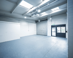
With the completion of Phase 1 of the Leeds Flood Alleviation Scheme, confidence has returned to 3,000 homes and 500 businesses in the city centre that were affected by Storm Eva in 2015. The scheme provides a one-in-75-year level of protection against flooding.
The £50 million project was undertaken as a joint venture between BAM Nuttall and Mott MacDonald, based on a design by ARUP for Leeds City Council. ARUP’s engineering teams devised a scheme that removed two main navigation weirs at Knostrop and Crown Point and replaced them with innovative mechanical moving weirs, which can be lowered as river levels rise to reduce flooding.
At Knostrop Cut, a whole island was removed and the canal and river merged, resulting in a navigable channel with greater water holding capacity.
Low-lying locations along the city centre, including embankments, terracing, and walls, were improved to provide greater protection against flooding.
Phase 2 – Kirkstall A65 Corridor
Planning permission was granted in June 2019 for Phase 2 of the Leeds Flood Alleviation Scheme, with a joint funding package of £75 million: £65 million from central government, £6 million from Leeds City Council, and £4 million from West Yorkshire Combined Authority.
The aim of Phase 2 is to reduce the risk of flooding using a catchment-wide approach offering a one-in-100-year level of protection. The project will again be undertaken as a joint venture between BAM Nuttall and Mott MacDonald.
8 km of flood walls will be installed along the River Aire from Leeds railway station up to Kirkstall Bridge.
Removal of obstructions along the river to reduce water levels.
Creation of new woodland areas.
Flood storage areas that release water only when it is safe to do so.
Phase 2 will be broken down into three key areas:
At Armley Mills and Kirkstall Trading Estate: new protective walls, a new higher bridge, and two new control structures on the goit (small water channel) which can close when river levels rise.
At Kirkstall Abbey: a new structure in front of the sluice gates will limit the volume of water entering the goit channel when river levels rise.
At Kirkstall Meadows: transformation of 2.4 hectares into wetland habitat and installation of a new flood embankment to reduce flood risk.
Construction of Phase 2 will take approximately 3 years to complete. Works will begin downstream near the city centre in December 2019. Construction around Kirkstall is expected to start in Autumn 2021 and take approximately 6 months. Detailed designs were to be made available in January 2020, with plans for Kirkstall featuring a 1.8-metre-high concrete clad wall.
Natural Flood Management
All along the River Aire, a new Natural Flood Management plan has been implemented. This includes the creation of new woodlands, woody debris dams, and wetlands, which have been proven to slow the flow of water and reduce flood risk.
The project begins at the source of the River Aire in Malham, North Yorkshire, and continues through the Yorkshire Dales National Park, Pendle, Craven, Bradford, and finally Leeds city centre.
Further Information
Background: Flooding in Leeds is nothing new. The worst flood on record occurred in 1866, when floodwater was 1 metre deep on Kirkstall Road. Since 2000, Leeds has experienced 7 floods. Storm Eva on 26th December 2015 caused the most damage, particularly in Kirkstall along the A65 corridor, at the railway station, and in the commercial areas of Stourton.
Before the completion of Phase 1, Leeds had no formal flood defences and was vulnerable to heavy downpours upstream.
Ongoing discussions about upgrading the scheme to a one-in-200-year level of protection are continuing between stakeholders.